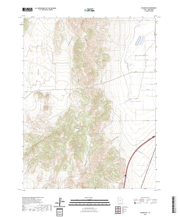
2023 Map of Sugarloaf
USGS Topo · Published 2023About this map
Juab Valley serves as a central corridor for rural infrastructure in this portion of Juab County, where agricultural and rangeland access is defined by a grid of named routes like Sheep Ln and W Airport Ln. The terrain is dominated by the prominent peak of Sugarloaf and the sprawling West Hills, which separate the valley floor from the western basins of Dog Valley. Water management in this arid landscape is marked by specific points of interest such as Government Spring and Orme Spring, alongside the seasonal flows of West Creek and Fourmile Creek. The transition from the flatlands of Big Hollow to the complex drainage systems of Cazier Canyon and Hall Canyon illustrates the geographical barriers that shaped early ranching and transit patterns throughout the region.
Find a feature on this map
25 named features on this map. Tap any name to fly to it.
Don’t see what you’re looking for? This feature index may not catch every label — zoom into the map to look around manually.
Map Details
Editions of this 2023 Sugarloaf Map
This is the sole edition of this map. No revisions or reprints were ever made.
Other maps of this area

1885 · Manti
USGS Topo · 1:250,000

1885 · Sevier Desert
USGS Topo · 1:250,000

1895 · Manti
USGS Topo · 1:250,000

1951 · Santaquin
USGS Topo · 1:62,500

1951 · Nephi
USGS Topo · 1:62,500

1953 · Delta
USGS Topo · 1:250,000

1954 · Tintic Mountain
USGS Topo · 1:24,000

1956 · Price
USGS Topo · 1:250,000

1958 · Delta
USGS Topo · 1:250,000

1960 · Price
USGS Topo · 1:250,000