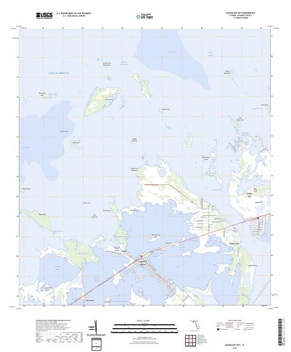
2025 Map of Sugarloaf Key
USGS Topo · Published 2025About this map
Sugarloaf Shores and the small settlement of Perky serve as central points in this island landscape where the Atlantic meets the Gulf of America. The map details a complex system of tidal channels and basins, including the Lower Sugarloaf Channel and Cudjoe Basin, which navigate through dense mangroves and keys. Local connectivity is defined by the Florida Keys Overseas Heritage Trl and Old US Hwy 1, which link Cudjoe Key to the surrounding archipelago.
Find a feature on this map
69 named features on this map. Tap any name to fly to it.
Don’t see what you’re looking for? This feature index may not catch every label — zoom into the map to look around manually.
Map Details
Editions of this 2025 Sugarloaf Key Map
This is the sole edition of this map. No revisions or reprints were ever made.
Other maps of this area

1921 · Sugar Loaf Key
USGS Topo · 1:62,500

1943 · Saddlebunch Keys
USGS Topo · 1:24,000

1943 · Boca Chica
USGS Topo · 1:24,000

1943 · Snipe Keys
USGS Topo · 1:24,000

1943 · Sugarloaf Key
USGS Topo · 1:24,000

1968 · Saddlebunch Keys
USGS Topo · 1:24,000
1971 · Boca Chica Key
USGS Topo · 1:24,000

1972 · Loggerhead Key
USGS Topo · 1:24,000
1972 · Sawyer Key
USGS Topo · 1:24,000

1972 · Content Keys
USGS Topo · 1:24,000