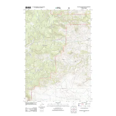
2012 Map of Sugarloaf Mountain
USGS Topo · Published 2012About this map
The settlement of Farrall sits at the eastern edge of this landscape, where the foothills of the Bear Lodge Mountains begin to rise in Crook County. High points like Sugarloaf Mountain and Skunk Peak define the local topography, overlooking a complex drainage system led by N Redwater Cr and Redwater Cr. The map reveals a land structured by water access and timber management, evidenced by sources like Merrick Spring and Dean Spring, alongside the prominent Hemler Reservoir to the southwest. The presence of several US Forest Service roads, such as Bearlodge Br 3D and the Taylor S Eastward Co Rd, highlights the area's role in the Black Hills National Forest region. Historic travel corridors like Government Valley Rd cut across the southern reaches, connecting isolated draws and mesas like Table Mountain through a network of canyons and high-elevation plateaus.
Find a feature on this map
32 named features on this map. Tap any name to fly to it.
Don’t see what you’re looking for? This feature index may not catch every label — zoom into the map to look around manually.
Map Details
Editions of this 2012 Sugarloaf Mountain Map
This is the sole edition of this map. No revisions or reprints were ever made.
Other maps of this area

1898 · Sundance
USGS Topo · 1:125,000

1901 · Aladdin
USGS Topo · 1:125,000

1902 · Sundance
USGS Topo · 1:125,000

1903 · Aladdin
USGS Topo · 1:125,000

1954 · Gillette
USGS Topo · 1:250,000

1955 · Gillette
USGS Topo · 1:250,000

1958 · Gillette
USGS Topo · 1:250,000

1958 · Beulah
USGS Topo · 1:62,500

1958 · Tinton
USGS Topo · 1:62,500

1958 · Sundance
USGS Topo · 1:62,500