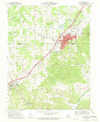
1969 Map of Sullivan
USGS Topo · Published 1971About this map
Sullivan emerges as a growing municipal hub at the junction of the St Louis - San Francisco railroad and modern highway transit during the late 1960s. The landscape is marked by the transition from industrial extraction to community expansion, evidenced by Claypits and a Claypit scattered near Elmont while newer developments like the Sullivan Country Club and a Drive-in Theater appear on the town's periphery. To the southwest, the town of Bourbon maintains its own distinct identity near the Hill Cem, while the rugged hills of Mineral Hill and Hyde lead down toward the Meramec River.
Find a feature on this map
47 named features on this map. Tap any name to fly to it.
Don’t see what you’re looking for? This feature index may not catch every label — zoom into the map to look around manually.
Map Details
Editions of this 1969 Sullivan Map
2 editions found
Other maps of this area

1903 · Sullivan
USGS Topo · 1:125,000

1934 · Meramec State Park
USGS Topo · 1:24,000

1935 · Gerald
USGS Topo · 1:48,000

1937 · Meramec State Park
USGS Topo · 1:24,000

1941 · Gerald
USGS Topo · 1:62,500

1944 · Gerald
USGS Topo · 1:62,500

1946 · Union
USGS Topo · 1:62,500

1947 · Sullivan
USGS Topo · 1:62,500

1948 · Leasburg
USGS Topo · 1:24,000

1948 · Argo
USGS Topo · 1:24,000