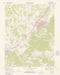
1969 Map of Sullivan
USGS Topo · Published 1980About this map
The St Louis - San Francisco railroad corridor serves as the primary spine for development across this 1960s landscape, connecting the growing hub of Sullivan with the neighboring town of Bourbon. Urban expansion is evident in the purple-tinted updates around Sullivan, where new residential streets and the Sullivan High School mark the town's northward reach toward Oak Grove. This era of mid-century infrastructure is anchored by landmarks like the Sullivan Memorial Airport and a Drive-in Theater, while the surrounding terrain remains deeply defined by narrow hollows and the winding course of the Meramec River. Rural life is well-documented through small community markers, including Wesleyan Church and several family burial grounds such as Finney Cemetery and St Anthony's Cemetery. Down toward the southern border, the map details the terrain around Camp Mihaska and the confluence of Blue Springs Creek and Crows Creek, revealing the persistent natural character of the Ozark foothills.
Find a feature on this map
45 named features on this map. Tap any name to fly to it.
Don’t see what you’re looking for? This feature index may not catch every label — zoom into the map to look around manually.
Map Details
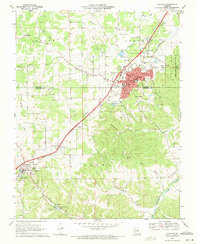
Editions of this 1969 Sullivan Map
2 editions found
Other maps of this area

1903 · Sullivan
USGS Topo · 1:125,000

1934 · Meramec State Park
USGS Topo · 1:24,000

1935 · Gerald
USGS Topo · 1:48,000

1937 · Meramec State Park
USGS Topo · 1:24,000

1941 · Gerald
USGS Topo · 1:62,500

1944 · Gerald
USGS Topo · 1:62,500

1946 · Union
USGS Topo · 1:62,500

1947 · Sullivan
USGS Topo · 1:62,500

1948 · Leasburg
USGS Topo · 1:24,000

1948 · Argo
USGS Topo · 1:24,000