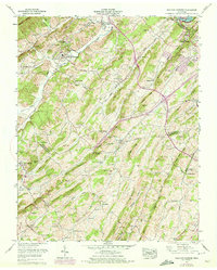
1959 Map of Sullivan Gardens
USGS Topo · Published 1972About this map
Sullivan Gardens and the South Fork Holston River corridor anchor this mid-century topographic portrait of Sullivan and Washington Counties. The landscape is defined by the corrugated ridges of Bays Mtn and Hemlock Ridge, where small valleys like Long Hollow and Smoky Valley Creek support a dense network of family cemeteries and rural schoolhouses. The presence of Kincheloe Mill along Horse Creek and the Sullivan High Sch suggests a community in transition, balancing its agricultural roots with suburban growth in Colonial Heights.
Find a feature on this map
90 named features on this map. Tap any name to fly to it.
Don’t see what you’re looking for? This feature index may not catch every label — zoom into the map to look around manually.
Map Details
Editions of this 1959 Sullivan Gardens Map
3 editions found
Other maps of this area

1891 · Roan Mountain
USGS Topo · 1:125,000

1892 · Greeneville
USGS Topo · 1:125,000

1894 · Roan Mountain
USGS Topo · 1:125,000

1894 · Estillville
USGS Topo · 1:125,000

1896 · Greeneville
USGS Topo · 1:125,000

1897 · Bristol
USGS Topo · 1:125,000

1902 · Bristol
USGS Topo · 1:125,000

1904 · Roan Mountain
USGS Topo · 1:125,000

1904 · Greeneville
USGS Topo · 1:125,000

1935 · Lovelace
USGS Topo · 1:24,000