
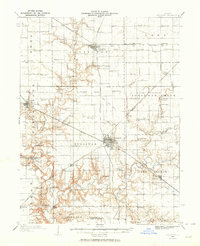
1935 Map of Sullivan
USGS Topo · Published 1935About this map
The town of Sullivan serves as a central hub in this mid-1930s survey of Moultrie County, showing a landscape defined by an extensive grid of country schools and small rail stops. The surrounding prairies are punctuated by an incredible density of local education centers, such as Stringtown Sch, Morning Star Sch, and Dyer Sch, reflecting a time when rural life revolved around these local townships. Rail transportation is a dominant feature, with the Wabash RR, Pennsylvania RR, and Illinois Central RR all intersecting the region, facilitating stops like Fairbanks Sta and Cushman Sta. Significant landmarks include the Masonic Home east of Sullivan and the Jonathan Creek Town Hall, which highlight the civic and social organization of the era. The terrain is divided by the winding path of the Kaskaskia River and Jonathan Creek, which provided natural drainage for the productive agricultural lands.
Find a feature on this map
69 named features on this map. Tap any name to fly to it.
Don’t see what you’re looking for? This feature index may not catch every label — zoom into the map to look around manually.
Map Details
Editions of this 1935 Sullivan Map
Other maps of this area

1929 · Decatur
USGS Topo · 1:62,500

1933 · Decatur
USGS Topo · 1:62,500

1934 · Mattoon
USGS Topo · 1:62,500

1935 · Arcola
USGS Topo · 1:48,000

1937 · Mattoon
USGS Topo · 1:62,500

1940 · Sullivan
USGS Topo · 1:62,500

1940 · Arcola
USGS Topo · 1:62,500

1942 · Shelbyville
USGS Topo · 1:62,500

1946 · Shelbyville
USGS Topo · 1:62,500

1947 · Stewardson
USGS Topo · 1:62,500