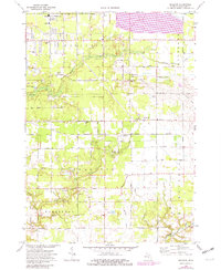
1972 Map of Sullivan
USGS Topo · Published 1982About this map
Wolf Lake and its surrounding community serve as the northern anchor for this study of Muskegon County, where rural crossroads and suburban expansion meet the low-lying drainage basins of Black Creek and Norris Creek. The landscape is a patchwork of agricultural fields and small woodlots, interrupted by specialized land uses such as the numerous Sandpits concentrated near Sternberg Road and the extensive Sewage Disposal Ponds west of Evanston Road. A significant transportation corridor is established by the Grand Trunk Western railroad, which bisects the townships of Sullivan and Ravenna.
Find a feature on this map
61 named features on this map. Tap any name to fly to it.
Don’t see what you’re looking for? This feature index may not catch every label — zoom into the map to look around manually.
Map Details
Editions of this 1972 Sullivan Map
2 editions found
Other maps of this area

1930 · Muskegon
USGS Topo · 1:62,500

1936 · Muskegon
USGS Topo · 1:62,500

1945 · Ravenna
USGS Topo · 1:62,500

1954 · Milwaukee
USGS Topo · 1:250,000

1954 · Midland
USGS Topo · 1:250,000

1958 · Midland
USGS Topo · 1:250,000

1958 · Milwaukee
USGS Topo · 1:250,000

1958 · Twin Lake
USGS Topo · 1:62,500

1958 · Fremont
USGS Topo · 1:62,500

1959 · Midland
USGS Topo · 1:250,000