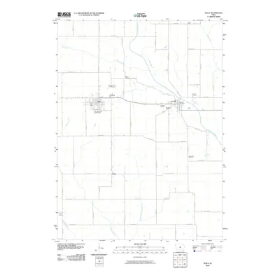
2010 Map of Sully
USGS Topo · Published 2010About this map
Sully and Lynnville serve as the primary hubs in this corner of Jasper County, Iowa, situated along the winding course of the North Skunk River. This landscape is deeply etched with local heritage, evidenced by a high density of rural burial grounds such as Swans Cemetery, Friends Cemetery, and Chester Cemetery. The map captures the agricultural regularity of the region, where a precise grid of roads like S 80th Ave E and Hwy T33 S connects isolated farmsteads and rural landmarks.
Find a feature on this map
54 named features on this map. Tap any name to fly to it.
Don’t see what you’re looking for? This feature index may not catch every label — zoom into the map to look around manually.
Map Details
Editions of this 2010 Sully Map
This is the sole edition of this map. No revisions or reprints were ever made.
Other maps of this area

1910 · Pella
USGS Topo · 1:62,500

1912 · Pella
USGS Topo · 1:62,500

1954 · Des Moines
USGS Topo · 1:250,000

1956 · Des Moines
USGS Topo · 1:250,000

1957 · Des Moines
USGS Topo · 1:250,000

1969 · Des Moines
USGS Topo · 1:250,000

1979 · Searsboro
USGS Topo · 1:24,000

1979 · Grinnell South
USGS Topo · 1:24,000

1980 · Sully
USGS Topo · 1:24,000
1980 · Peoria
USGS Topo · 1:24,000