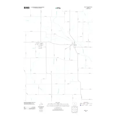
2013 Map of Sully
USGS Topo · Published 2013About this map
The N Skunk River carves a diagonal path through Jasper County, Iowa, defining the local topography between the rural communities of Sully and Lynnville. This early 21st-century landscape is characterized by a precise grid of agricultural roads, such as E 124th ST S and S 68th Ave E, which partition the fertile terrain. On the western edge of the quadrangle, the Sully Municipal Airport serves as a modern waypoint for the region. The drainage network is particularly detailed, showing how tributaries like Buckley Cr, Slater Cr, and Middle Br Buckley Cr feed into the Skunk River valley. This layout reveals a mature Midwestern agricultural society where long-established townships are interconnected by a blend of county highways and local farm-to-market routes.
Find a feature on this map
77 named features on this map. Tap any name to fly to it.
Don’t see what you’re looking for? This feature index may not catch every label — zoom into the map to look around manually.
Map Details
Editions of this 2013 Sully Map
This is the sole edition of this map. No revisions or reprints were ever made.
Other maps of this area

1910 · Pella
USGS Topo · 1:62,500

1912 · Pella
USGS Topo · 1:62,500

1954 · Des Moines
USGS Topo · 1:250,000

1956 · Des Moines
USGS Topo · 1:250,000

1957 · Des Moines
USGS Topo · 1:250,000

1969 · Des Moines
USGS Topo · 1:250,000

1979 · Searsboro
USGS Topo · 1:24,000

1979 · Grinnell South
USGS Topo · 1:24,000

1980 · Sully
USGS Topo · 1:24,000
1980 · Peoria
USGS Topo · 1:24,000