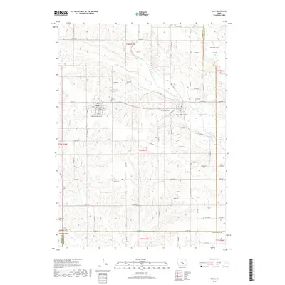
2018 Map of Sully
USGS Topo · Published 2018About this map
Sully and Lynnville anchor this portion of Jasper County, Iowa, where the landscape is defined by the winding course of the North Skunk River and its various tributaries like Slater Cr and Buckley Cr. The map reveals a deeply rooted agrarian community, evidenced by the high concentration of small cemeteries marking the countryside. These include sites such as Swans Cem, New Salem Cem, and Chester Cem, which often represent the earliest pioneers of the township.
Find a feature on this map
80 named features on this map. Tap any name to fly to it.
Don’t see what you’re looking for? This feature index may not catch every label — zoom into the map to look around manually.
Map Details
Editions of this 2018 Sully Map
This is the sole edition of this map. No revisions or reprints were ever made.
Other maps of this area

1910 · Pella
USGS Topo · 1:62,500

1912 · Pella
USGS Topo · 1:62,500

1954 · Des Moines
USGS Topo · 1:250,000

1956 · Des Moines
USGS Topo · 1:250,000

1957 · Des Moines
USGS Topo · 1:250,000

1969 · Des Moines
USGS Topo · 1:250,000

1979 · Searsboro
USGS Topo · 1:24,000

1979 · Grinnell South
USGS Topo · 1:24,000

1980 · Sully
USGS Topo · 1:24,000
1980 · Peoria
USGS Topo · 1:24,000