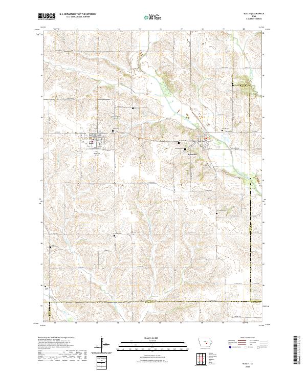
2022 Map of Sully
USGS Topo · Published 2022About this map
The North Skunk River meanders across the eastern portion of this Jasper County landscape, defining the topography around the settlement of Lynnville. This rural region is characterized by a high density of small family and community burial grounds, such as Swan Cem, Sully Cem, and Friends Cem, which serve as vital markers for local genealogical research. The town of Sully serves as a primary hub in the west, supported by the Sully Municipal Airport.
Find a feature on this map
60 named features on this map. Tap any name to fly to it.
Don’t see what you’re looking for? This feature index may not catch every label — zoom into the map to look around manually.
Map Details
Editions of this 2022 Sully Map
This is the sole edition of this map. No revisions or reprints were ever made.
Other maps of this area

1910 · Pella
USGS Topo · 1:62,500

1912 · Pella
USGS Topo · 1:62,500

1954 · Des Moines
USGS Topo · 1:250,000

1956 · Des Moines
USGS Topo · 1:250,000

1957 · Des Moines
USGS Topo · 1:250,000

1969 · Des Moines
USGS Topo · 1:250,000

1979 · Searsboro
USGS Topo · 1:24,000

1979 · Grinnell South
USGS Topo · 1:24,000

1980 · Sully
USGS Topo · 1:24,000
1980 · Peoria
USGS Topo · 1:24,000