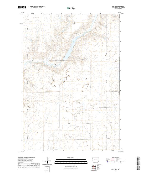
2021 Map of Sully Lake
USGS Topo · Published 2021About this map
Sully Lake and the winding course of Okobojo Creek anchor this agricultural landscape in Sully County. The terrain is defined by the deep incisions of the creek drainage, which cuts through the high plains to create a series of bluffs and coulees. A strict section-line road grid, including Onida Rd and a series of numbered east-west corridors from 183rd St down to 190th St, organizes the territory into a patchwork of large-scale farming tracts. This 2021 update reflects the contemporary rural infrastructure of central South Dakota, where the land-use pattern remains dominated by the Public Land Survey System. The inclusion of Sully Pl near the lake suggests localized recreational or residential access within this otherwise expansive prairie environment.
Find a feature on this map
16 named features on this map. Tap any name to fly to it.
Don’t see what you’re looking for? This feature index may not catch every label — zoom into the map to look around manually.
Map Details
Editions of this 2021 Sully Lake Map
This is the sole edition of this map. No revisions or reprints were ever made.
Other maps of this area

1954 · Pierre
USGS Topo · 1:250,000

1958 · Pierre
USGS Topo · 1:250,000

1965 · Artichoke Butte
USGS Topo · 1:24,000

1965 · Agar SW
USGS Topo · 1:24,000

1965 · Okobojo NE
USGS Topo · 1:24,000

1965 · Agar
USGS Topo · 1:24,000

1965 · Sully Lake
USGS Topo · 1:24,000

1967 · Onida SE
USGS Topo · 1:24,000

1967 · Onida SW
USGS Topo · 1:24,000
1967 · Okobojo SE
USGS Topo · 1:24,000