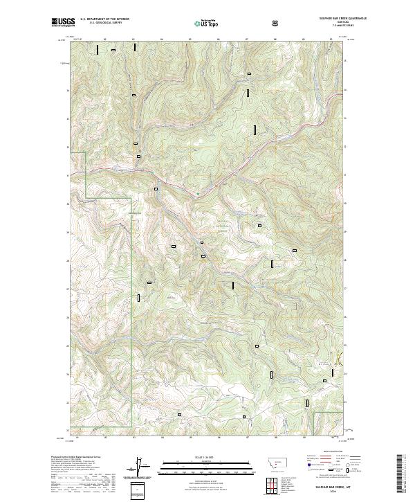
2024 Map of Sulphur Bar Creek
USGS Topo · Published 2024About this map
Helena National Forest dominates this section of the Big Belt Mountains, where a complex network of forest roads and pack trails navigates the high elevations between the Missouri River drainage and the Smith River watershed. The historic Flathead Indian Trail Rd provides a significant touchstone for early trans-mountain movement, cutting across the center of the map toward the southern drainages. High points like Grassy Mtn and Black Butte overlook the narrow valleys formed by Sulphur Bar Creek and the upper reaches of Greyson Creek. The landscape transitions from the open timber and meadows of Munding Flat to steep canyons carved by Deep Creek and its tributaries, including Cedar Bar Creek. This modern survey documents the contemporary trail system, featuring the Klondike Pass Connection Trl and various routes along Windy Ridge, illustrating the ongoing management of this wilderness terrain for recreation and conservation.
Find a feature on this map
34 named features on this map. Tap any name to fly to it.
Don’t see what you’re looking for? This feature index may not catch every label — zoom into the map to look around manually.
Map Details
Editions of this 2024 Sulphur Bar Creek Map
This is the sole edition of this map. No revisions or reprints were ever made.
Other maps of this area

1886 · Fort Logan
USGS Topo · 1:250,000

1948 · White Sulphur Springs
USGS Topo · 1:250,000

1949 · Maudlow
USGS Topo · 1:62,500

1949 · Toston
USGS Topo · 1:62,500

1950 · Duck Creek Pass
USGS Topo · 1:62,500

1958 · White Sulphur Springs
USGS Topo · 1:250,000

1961 · White Sulphur Springs
USGS Topo · 1:250,000

1965 · White Sulphur Springs
USGS Topo · 1:250,000
1971 · Battle Mountain
USGS Topo · 1:24,000
1971 · Mount Edith
USGS Topo · 1:24,000