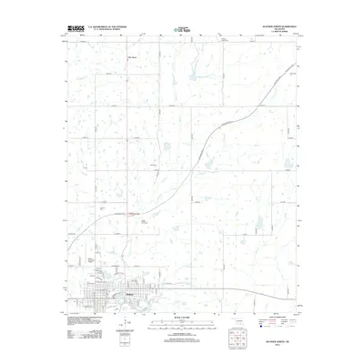
2012 Map of Sulphur North
USGS Topo · Published 2012About this map
Sulphur anchors the southern portion of this landscape, where the grid of city streets gives way to a concentration of hydrological features along Travertine Cr. This area is defined by its numerous mineral springs and waterfalls, including Sulphur Springs, Antelope Spring, and Buffalo Spring, alongside landmarks such as Little Niagara Falls and Grand Rapids. The map reveals a transition from the urban center of Sulphur to the rural north, where the settlement of Oak Grove sits amid a network of drainage systems like Rock Cr and Guy Cr.
Find a feature on this map
86 named features on this map. Tap any name to fly to it.
Don’t see what you’re looking for? This feature index may not catch every label — zoom into the map to look around manually.
Map Details
Editions of this 2012 Sulphur North Map
This is the sole edition of this map. No revisions or reprints were ever made.
Other maps of this area

1898 · Pauls Valley
USGS Topo · 1:125,000

1901 · Stonewall
USGS Topo · 1:125,000

1901 · Tishomingo
USGS Topo · 1:125,000

1901 · Ardmore
USGS Topo · 1:125,000

1902 · Pauls Valley
USGS Topo · 1:125,000

1918 · Ardmore
USGS Topo · 1:125,000

1957 · Ardmore
USGS Topo · 1:250,000

1963 · Ardmore
USGS Topo · 1:250,000

1963 · Sulphur South
USGS Topo · 1:24,000

1963 · Mill Creek
USGS Topo · 1:24,000