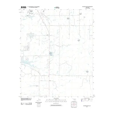
2010 Map of Sulphur South
USGS Topo · Published 2010About this map
Sulphur and the rural community of Drake anchor this Murray County landscape, which is defined by a complex network of water management and recreation at the start of the 2010s. The northern edge features landmarks like Robbers Roost Hill and Bromide Hill, overlooking the Little Niagara Dam. Central to the geography is the Lake of the Arbuckles, a major reservoir fed by tributaries such as Buckhorn Creek and Dry Branch.
Find a feature on this map
47 named features on this map. Tap any name to fly to it.
Don’t see what you’re looking for? This feature index may not catch every label — zoom into the map to look around manually.
Map Details
Editions of this 2010 Sulphur South Map
This is the sole edition of this map. No revisions or reprints were ever made.
Other maps of this area

1898 · Pauls Valley
USGS Topo · 1:125,000

1901 · Stonewall
USGS Topo · 1:125,000

1901 · Tishomingo
USGS Topo · 1:125,000

1901 · Ardmore
USGS Topo · 1:125,000

1902 · Pauls Valley
USGS Topo · 1:125,000

1918 · Ardmore
USGS Topo · 1:125,000

1957 · Ardmore
USGS Topo · 1:250,000

1963 · Ardmore
USGS Topo · 1:250,000

1963 · Sulphur South
USGS Topo · 1:24,000

1963 · Mill Creek
USGS Topo · 1:24,000