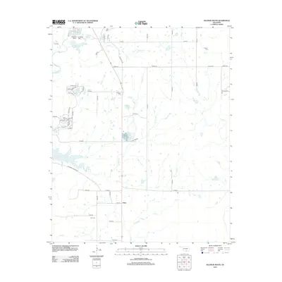
2012 Map of Sulphur South
USGS Topo · Published 2012About this map
Lake of the Arbuckles dominates the western edge of this Murray County landscape, where the waters of Rock Cr and Dry Br gather. To the south, the Chickasaw Wildlife Mgt area preserves the transition from the lake shore to the interior creek valleys. Geologic landmarks like Bromide Hill and Robbers Roost sit near the northern boundary, where the area's mineral heritage is evident in the presence of Bromide Springs and the Sulphur Asphalt Spring. The settlement of Drake serves as a central point for local genealogy, supported by the nearby Drake Cem, while the eastern portion of the map is defined by the winding course of Mill Cr and Buckhorn Cr. Isolated springs like Lowrance Springs dot the terrain, illustrating the groundwater-rich environment that has historically defined this Oklahoma region.
Find a feature on this map
61 named features on this map. Tap any name to fly to it.
Don’t see what you’re looking for? This feature index may not catch every label — zoom into the map to look around manually.
Map Details
Editions of this 2012 Sulphur South Map
This is the sole edition of this map. No revisions or reprints were ever made.
Other maps of this area

1898 · Pauls Valley
USGS Topo · 1:125,000

1901 · Stonewall
USGS Topo · 1:125,000

1901 · Tishomingo
USGS Topo · 1:125,000

1901 · Ardmore
USGS Topo · 1:125,000

1902 · Pauls Valley
USGS Topo · 1:125,000

1918 · Ardmore
USGS Topo · 1:125,000

1957 · Ardmore
USGS Topo · 1:250,000

1963 · Ardmore
USGS Topo · 1:250,000

1963 · Sulphur South
USGS Topo · 1:24,000

1963 · Mill Creek
USGS Topo · 1:24,000