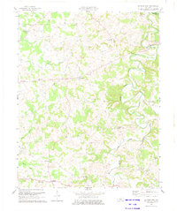
1973 Map of Sulphur Well
USGS Topo · Published 1975About this map
The Little Fork Barren River carves a deep, winding path through this portion of Metcalfe and Green Counties, defining the geography of a rural landscape dotted with small crossroads communities. At the time of this 1973 revision, the region maintained its character as a collection of family-centered settlements, anchored by rural institutions like North Metcalfe Sch and a series of country houses of worship including Pleasant Valley Ch, Bethlehem Ch, and Antioch Ch.
Find a feature on this map
30 named features on this map. Tap any name to fly to it.
Don’t see what you’re looking for? This feature index may not catch every label — zoom into the map to look around manually.
Map Details
Editions of this 1973 Sulphur Well Map
2 editions found
Other maps of this area

1935 · Horse Cave
USGS Topo · 1:48,000

1938 · Horse Cave
USGS Topo · 1:62,500

1953 · Sulphur Well
USGS Topo · 1:24,000

1953 · Temple Hill
USGS Topo · 1:24,000

1953 · Edmonton
USGS Topo · 1:24,000

1953 · Summer Shade
USGS Topo · 1:24,000

1953 · Exie
USGS Topo · 1:24,000

1953 · Center
USGS Topo · 1:24,000

1953 · East Fork
USGS Topo · 1:24,000

1954 · Park
USGS Topo · 1:24,000