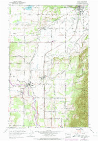
1952 Map of Sumas
USGS Topo · Published 1974About this map
The Canada-United States border defines the northern edge of this 1952 landscape, where the settlement of Sumas serves as a key international gateway. The region is shaped by the winding courses of the Nooksack River and the Sumas River, supporting a network of small agricultural and rail-oriented communities including Everson, Nooksack, and Clearbrook. This era shows the critical role of rail transport in Whatcom County, with the Chicago Milwaukee St Paul & Pacific and the Burlington Northern lines intersecting near Hampton and Everson. Local landmarks like the Nooksack Valley High School and various cemeteries provide essential touchpoints for genealogists. The terrain transitions from the river lowlands to the rising slopes of Sumas Mountain in the southeast, while the northern border area includes unique features like Judson Lake, which straddles the international boundary line.
Find a feature on this map
47 named features on this map. Tap any name to fly to it.
Don’t see what you’re looking for? This feature index may not catch every label — zoom into the map to look around manually.
Map Details
Editions of this 1952 Sumas Map
5 editions found
Other maps of this area

1906 · Sumas
USGS Topo · 1:62,500

1908 · Sumas
USGS Topo · 1:62,500

1919 · Van Zandt
USGS Topo · 1:62,500

1951 · Van Zandt
USGS Topo · 1:62,500

1952 · Lynden
USGS Topo · 1:24,000

1952 · Lawrence
USGS Topo · 1:24,000

1952 · Sumas
USGS Topo · 1:24,000

1954 · Bellingham North
USGS Topo · 1:24,000

1954 · Lynden
USGS Topo · 1:62,500

1957 · Victoria
USGS Topo · 1:250,000