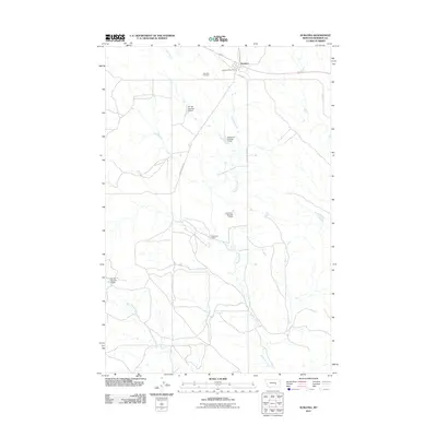
2011 Map of Sumatra
USGS Topo · Published 2011About this map
Sumatra serves as the focal point of this Rosebud County landscape, situated along the northern edge where the Sumatra Post Office and Sumatra Cemetery anchor the small community. This portion of Montana's high plains is defined by a series of ranching infrastructure and water management features, including the Bar 69 Number 4 Dam and multiple structures at the Kesterson Ranch. The drainage of Muggins Creek and its tributary West Muggins Creek carve through the center of the sheet, providing essential water access for the various livestock operations. Local transportation is facilitated by named routes such as Sumatra Rd and Muggins Gap Rd, which connect the isolated homesteads and dam sites. The presence of numerous numbered dams like Kesterson Number 1 Dam illustrates the intensive water management required for sustainable prairie ranching in the early 21st century.
Find a feature on this map
15 named features on this map. Tap any name to fly to it.
Don’t see what you’re looking for? This feature index may not catch every label — zoom into the map to look around manually.
Map Details
Editions of this 2011 Sumatra Map
This is the sole edition of this map. No revisions or reprints were ever made.
Other maps of this area

1954 · Forsyth
USGS Topo · 1:250,000

1957 · Forsyth
USGS Topo · 1:250,000

1958 · Forsyth
USGS Topo · 1:250,000

1960 · Yablonski Ranch
USGS Topo · 1:24,000

1960 · Ingomar West
USGS Topo · 1:24,000

1960 · Mc Konkey Creek
USGS Topo · 1:24,000

1962 · Guthridge Ranch
USGS Topo · 1:24,000

1962 · Sumatra
USGS Topo · 1:24,000

1962 · Grebe Ranch
USGS Topo · 1:24,000

1963 · Hecker Ranch
USGS Topo · 1:24,000