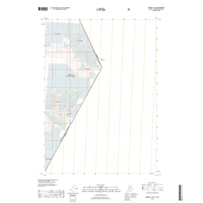
2018 Map of Sumdum A-1 NW
USGS Topo · Published 2018About this map
The international boundary between Canada and the United States of America cuts diagonally through this high-altitude landscape in the Coast Mountains. This survey documents a wilderness dominated by ice and rock, where the Baird Glacier flows through the northern reaches of the Tongass National Forest. Significant peaks like Mt Burkett define the local topography, which is largely comprised of federal forest lands and rugged alpine terrain. The map provides a clear visualization of the township and range survey lines, including t53s r83e and t54s r82e, as they interact with the international border at the edge of British Columbia.
Find a feature on this map
10 named features on this map. Tap any name to fly to it.
Don’t see what you’re looking for? This feature index may not catch every label — zoom into the map to look around manually.
Map Details
Editions of this 2018 Sumdum A-1 NW Map
This is the sole edition of this map. No revisions or reprints were ever made.
Other maps of this area

1952 · Sumdum
USGS Topo · 1:250,000

1960 · Sumdum A-1
USGS Topo · 1:63,360

1961 · Sumdum A-2
USGS Topo · 1:63,360

1961 · Sumdum B-2
USGS Topo · 1:63,360

1961 · Sumdum
USGS Topo · 1:250,000

2000 · Sumdum A-2
USGS Topo · 1:63,360

2000 · Sumdum B-2
USGS Topo · 1:63,360
2018 · Sumdum A-2 NE
USGS Topo · 1:25,000
2018 · Sumdum A-1 SE
USGS Topo · 1:25,000
2018 · Sumdum B-2 OE E SW
USGS Topo · 1:25,000