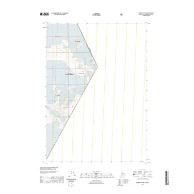
2021 Map of Sumdum A-1 NW
USGS Topo · Published 2021About this map
Mt Burkett dominates the high-altitude landscape of the Coast Mountains, marking a prominent point in this glaciated frontier. This 2021 topographic survey focuses on the international boundary where Canada meets the United States, with much of the American side protected within the Tongass National Forest. The map detail captures a terrain of extreme relief and ice, defined by the Public Land Survey System grids of t53s r83e and t54s r82e. As part of the Alaska-Petersburg Borough area, the sheet illustrates the sheer isolation of this borderland, where traditional human infrastructure is absent in favor of natural features and precisely defined political boundaries.
Find a feature on this map
8 named features on this map. Tap any name to fly to it.
Don’t see what you’re looking for? This feature index may not catch every label — zoom into the map to look around manually.
Map Details
Editions of this 2021 Sumdum A-1 NW Map
This is the sole edition of this map. No revisions or reprints were ever made.
Other maps of this area

1952 · Sumdum
USGS Topo · 1:250,000

1960 · Sumdum A-1
USGS Topo · 1:63,360

1961 · Sumdum A-2
USGS Topo · 1:63,360

1961 · Sumdum B-2
USGS Topo · 1:63,360

1961 · Sumdum
USGS Topo · 1:250,000

2000 · Sumdum A-2
USGS Topo · 1:63,360

2000 · Sumdum B-2
USGS Topo · 1:63,360
2018 · Sumdum A-1 NW
USGS Topo · 1:25,000
2018 · Sumdum A-2 NE
USGS Topo · 1:25,000
2018 · Sumdum A-1 SE
USGS Topo · 1:25,000