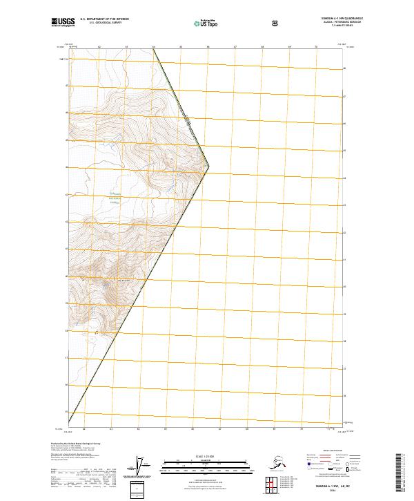
2024 Map of Sumdum A-1 NW
USGS Topo · Published 2024About this map
Tongass National Forest dominates this high-altitude landscape along the international border in Petersburg Borough. The terrain is defined by extreme vertical relief, culminating in the prominent peak of Mt Burkett in the southern portion of the quadrangle. This map documents a strictly natural landscape where the boundary between the Canada United States of America follows the rugged crests of the coastal range. The absence of roads or permanent settlements underscores the wilderness character of this region, which remains a critical area for glaciological study and high-alpine exploration within the larger Alaskan panhandle.
Find a feature on this map
7 named features on this map. Tap any name to fly to it.
Don’t see what you’re looking for? This feature index may not catch every label — zoom into the map to look around manually.
Map Details
Editions of this 2024 Sumdum A-1 NW Map
This is the sole edition of this map. No revisions or reprints were ever made.
Other maps of this area

1952 · Sumdum
USGS Topo · 1:250,000

1960 · Sumdum A-1
USGS Topo · 1:63,360

1961 · Sumdum A-2
USGS Topo · 1:63,360

1961 · Sumdum B-2
USGS Topo · 1:63,360

1961 · Sumdum
USGS Topo · 1:250,000

2000 · Sumdum A-2
USGS Topo · 1:63,360

2000 · Sumdum B-2
USGS Topo · 1:63,360
2018 · Sumdum A-1 NW
USGS Topo · 1:25,000
2018 · Sumdum A-2 NE
USGS Topo · 1:25,000
2018 · Sumdum A-1 SE
USGS Topo · 1:25,000