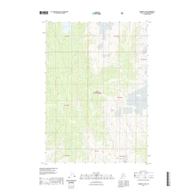
2021 Map of Sumdum A-3 NW
USGS Topo · Published 2021About this map
Tongass National Forest dominates the interior of this coastal Alaskan landscape, where the Farragut River carves a deep valley toward the northwest corner of the quadrangle. The river’s drainage is fed by several high-elevation features, including Farragut Lake and the precipitous slopes of the Coast Mountains. This 2021 survey reveals a primitive and high-relief terrain where prominent summits such as Gray Peak, Henry Peak, and Dana Peak provide essential orientation markers for navigators and surveyors. In the southeastern reaches, Marsh Peak stands as a final sentinel before the land gives way to further glacial valleys. The map illustrates a landscape shaped by hydrology and elevation, showing the intricate relationship between the river system and the massive mountain ranges that define the Alaska-Canada borderlands.
Find a feature on this map
14 named features on this map. Tap any name to fly to it.
Don’t see what you’re looking for? This feature index may not catch every label — zoom into the map to look around manually.
Map Details
Editions of this 2021 Sumdum A-3 NW Map
This is the sole edition of this map. No revisions or reprints were ever made.
Other maps of this area

1943 · Sumdum B-4
USGS Topo · 1:63,360

1948 · Sumdum A-4
USGS Topo · 1:63,360

1948 · Sumdum B-4
USGS Topo · 1:63,360

1951 · Sumdum A-4
USGS Topo · 1:63,360

1952 · Sumdum
USGS Topo · 1:250,000

1961 · Sumdum A-3
USGS Topo · 1:63,360

1961 · Sumdum B-3
USGS Topo · 1:63,360

1961 · Sumdum
USGS Topo · 1:250,000

1996 · Sumdum B-3
USGS Topo · 1:63,360

1996 · Sumdum B-4
USGS Topo · 1:63,360