
1961 Map of Sumdum B-3
USGS Topo · Published 1966About this map
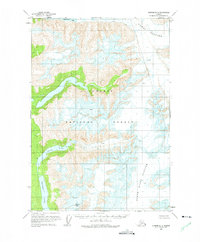
Dawes Glacier and Baird Glacier dominate this glaciated landscape of Southeast Alaska as it appeared in the mid-twentieth century. The vast ice fields are characterized by numerous crevasses, while Maury Peak stands as a prominent landmark amidst the high-altitude terrain. Located within the Tongass National Forest, the map captures a primitive wilderness where water bodies like Glory Lake and Farragut Lake are fed by the surrounding glacial system. The northern edge is marked by the tidal waters of Endicott Arm, illustrating the complex relationship between the fjord systems and the receding ice. This 1961 survey, based on aerial photography from 1948 and 1961, provides a detailed look at unsurveyed and unmarked land lines as computed by the State of Alaska, Division of Lands during the early years of statehood.
Find a feature on this map
8 named features on this map. Tap any name to fly to it.
Don’t see what you’re looking for? This feature index may not catch every label — zoom into the map to look around manually.
Map Details
Editions of this 1961 Sumdum B-3 Map
2 editions found
Other maps of this area

1943 · Sumdum B-4
USGS Topo · 1:63,360

1948 · Sumdum A-4
USGS Topo · 1:63,360

1948 · Sumdum B-4
USGS Topo · 1:63,360

1951 · Sumdum A-4
USGS Topo · 1:63,360

1952 · Sumdum
USGS Topo · 1:250,000

1961 · Sumdum A-2
USGS Topo · 1:63,360

1961 · Sumdum C-3
USGS Topo · 1:63,360

1961 · Sumdum B-2
USGS Topo · 1:63,360

1961 · Sumdum C-4
USGS Topo · 1:63,360

1961 · Sumdum A-3
USGS Topo · 1:63,360