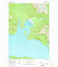
1951 Map of Sumdum A-4
USGS Topo · Published 1974About this map
Frederick Sound dominates the southern reaches of this maritime survey, where the waters of Farragut Bay and the Farragut River meet the coastal wilderness. Along the shoreline of Read Island and the northern coast of Kupreanof Island, small isolated Cabin and Cabins signify the early 1950s presence of hunters, fishers, or homesteaders in this remote stretch of Southeast Alaska. The landscape is defined by its deep tidal arms, such as North Arm and South Arm, which reach toward the steep interior peaks.
Find a feature on this map
32 named features on this map. Tap any name to fly to it.
Don’t see what you’re looking for? This feature index may not catch every label — zoom into the map to look around manually.
Map Details
Editions of this 1951 Sumdum A-4 Map
2 editions found
Other maps of this area

1943 · Sumdum B-4
USGS Topo · 1:63,360

1948 · Sumdum A-4
USGS Topo · 1:63,360

1948 · Sumdum A-5
USGS Topo · 1:63,360

1948 · Sumdum B-5
USGS Topo · 1:63,360

1948 · Sumdum B-4
USGS Topo · 1:63,360

1948 · Petersburg D-5
USGS Topo · 1:63,360

1951 · Petersburg D-4
USGS Topo · 1:63,360

1951 · Sumdum A-4
USGS Topo · 1:63,360

1951 · Sumdum B-5
USGS Topo · 1:63,360

1952 · Petersburg
USGS Topo · 1:250,000