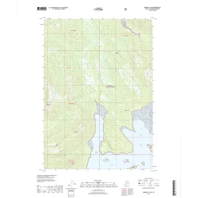
2017 Map of Sumdum A-4 NW
USGS Topo · Published 2017About this map
Tongass National Forest blankets this corner of the Petersburg Borough, where the dramatic elevation changes of the Coast Mountains meet the complex waterways of Southeast Alaska. This maritime landscape is defined by the deep indentations of Farragut Bay, which branches into the North Arm and South Arm. These glacial-carved waters provide natural havens like Francis Anchorage, essential for navigation in a region where the shoreline is often steep and inaccessible.
Find a feature on this map
19 named features on this map. Tap any name to fly to it.
Don’t see what you’re looking for? This feature index may not catch every label — zoom into the map to look around manually.
Map Details
Editions of this 2017 Sumdum A-4 NW Map
This is the sole edition of this map. No revisions or reprints were ever made.
Other maps of this area

1943 · Sumdum B-4
USGS Topo · 1:63,360

1948 · Sumdum A-4
USGS Topo · 1:63,360

1948 · Sumdum A-5
USGS Topo · 1:63,360

1948 · Sumdum B-5
USGS Topo · 1:63,360

1948 · Sumdum B-4
USGS Topo · 1:63,360

1951 · Sumdum A-4
USGS Topo · 1:63,360

1951 · Sumdum B-5
USGS Topo · 1:63,360

1952 · Sumdum
USGS Topo · 1:250,000

1961 · Sumdum
USGS Topo · 1:250,000

1996 · Sumdum B-4
USGS Topo · 1:63,360