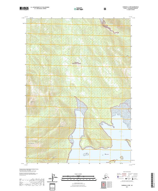
2021 Map of Sumdum A-4 NW
USGS Topo · Published 2021About this map
The Tongass National Forest dominates this Alaskan landscape, where the Coast Mountains meet the intricate tidal waters of the Holkham Bay area. This 2021 survey documents the dramatic verticality of the terrain, rising from the North Arm and South Arm to sharp summits. Distinctive topographical features like Jamestown Peak, Saranac Peak, and Alaska Peak overlook the deep fjord-like waters. Navigational points such as Francis Anchorage and the narrow Sanborn Canal provide critical orientation along the shoreline, while smaller maritime landmarks like Flock Rock and Bay Point Knoll mark the boundary between the sea and the high alpine slopes of Man-of-War Peak. The map illustrates a wilderness defined by steep contours and glacial carved inlets, largely untouched by infrastructure but rich in named natural features.
Find a feature on this map
19 named features on this map. Tap any name to fly to it.
Don’t see what you’re looking for? This feature index may not catch every label — zoom into the map to look around manually.
Map Details
Editions of this 2021 Sumdum A-4 NW Map
This is the sole edition of this map. No revisions or reprints were ever made.
Other maps of this area

1943 · Sumdum B-4
USGS Topo · 1:63,360

1948 · Sumdum A-4
USGS Topo · 1:63,360

1948 · Sumdum A-5
USGS Topo · 1:63,360

1948 · Sumdum B-5
USGS Topo · 1:63,360

1948 · Sumdum B-4
USGS Topo · 1:63,360

1951 · Sumdum A-4
USGS Topo · 1:63,360

1951 · Sumdum B-5
USGS Topo · 1:63,360

1952 · Sumdum
USGS Topo · 1:250,000

1961 · Sumdum
USGS Topo · 1:250,000

1996 · Sumdum B-4
USGS Topo · 1:63,360