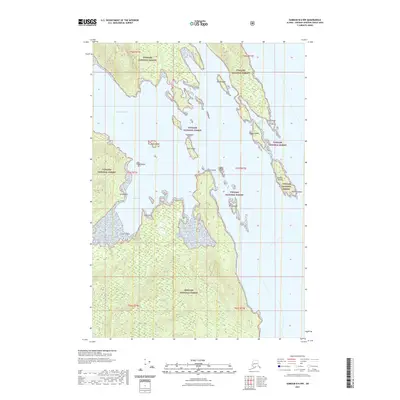
2021 Map of Sumdum B-6 NW
USGS Topo · Published 2021About this map
Gambier Bay defines this coastal stretch of the Tongass National Forest, where a complex network of islands and protected inlets has long shaped navigation. The geography is characterized by numerous small landforms such as Muse Island, Tree Island, and the distinctive Cairn Island that sit within the larger waterway. Significant nautical landmarks including Point Gambier and Church Point serve as essential reference points for those traversing these waters.
Find a feature on this map
25 named features on this map. Tap any name to fly to it.
Don’t see what you’re looking for? This feature index may not catch every label — zoom into the map to look around manually.
Map Details
Editions of this 2021 Sumdum B-6 NW Map
This is the sole edition of this map. No revisions or reprints were ever made.
Other maps of this area

1948 · Sitka B-1
USGS Topo · 1:63,360

1948 · Sitka C-1
USGS Topo · 1:63,360

1948 · Sumdum B-6
USGS Topo · 1:63,360

1948 · Sumdum C-6
USGS Topo · 1:63,360

1951 · Sitka
USGS Topo · 1:250,000

1951 · Sitka C-1
USGS Topo · 1:63,360

1951 · Sitka B-1
USGS Topo · 1:63,360

1951 · Sumdum C-6
USGS Topo · 1:63,360

1952 · Sumdum
USGS Topo · 1:250,000

1952 · Sitka
USGS Topo · 1:250,000