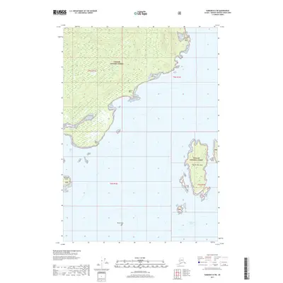
2017 Map of Sumdum B-6 SW
USGS Topo · Published 2017About this map
Tongass National Forest dominates this coastal Alaskan landscape, where the Admiralty Island coastline meets the cold waters of Frederick Sound. The geography is defined by a complex network of bays and islets, most notably Pybus Bay and the surrounding San Juan Islands. Key navigation landmarks such as False Point Pybus, Square Point, and Point Pybus define the jagged shoreline, while inland, the terrain transition is marked by Old Mans Slough. Further offshore, the twin landmasses of West Brother Island and East Brother Island stand alongside Round Rock, illustrating the archipelago's characteristic fragmentation. This survey documents a largely undeveloped wilderness within the TNF boundaries, preserving the coastal profile of the Hoonah-Angoon Census Area as it appeared in the early 21st century.
Find a feature on this map
16 named features on this map. Tap any name to fly to it.
Don’t see what you’re looking for? This feature index may not catch every label — zoom into the map to look around manually.
Map Details
Editions of this 2017 Sumdum B-6 SW Map
This is the sole edition of this map. No revisions or reprints were ever made.
Other maps of this area

1948 · Sitka B-1
USGS Topo · 1:63,360

1948 · Sumdum A-6
USGS Topo · 1:63,360

1948 · Sumdum B-6
USGS Topo · 1:63,360

1948 · Sitka A-1
USGS Topo · 1:63,360

1951 · Sitka
USGS Topo · 1:250,000

1951 · Sitka B-1
USGS Topo · 1:63,360

1952 · Sumdum
USGS Topo · 1:250,000

1952 · Sitka
USGS Topo · 1:250,000

1961 · Sumdum
USGS Topo · 1:250,000

1964 · Sitka
USGS Topo · 1:250,000