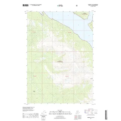
2017 Map of Sumdum C-4 SW
USGS Topo · Published 2017About this map
Hobart Bay defines the southwestern coastline of this wilderness corridor within the Tongass National Forest. The landscape is dominated by the steep, rising elevations of the Coast Mountains, where narrow drainages like Spruce Cr and Sylvia Cr flow westward toward the saltwater. This 2017 survey details a largely undeveloped coastal environment where high-altitude water bodies such as Placer Lakes feed into the Chuck River system. The map provides a clear look at the intricate topography and drainage patterns characteristic of Southeast Alaska, illustrating the sharp transition from the tidal waters of the bay to the glaciated peaks of the mainland interior.
Find a feature on this map
12 named features on this map. Tap any name to fly to it.
Don’t see what you’re looking for? This feature index may not catch every label — zoom into the map to look around manually.
Map Details
Editions of this 2017 Sumdum C-4 SW Map
This is the sole edition of this map. No revisions or reprints were ever made.
Other maps of this area

1943 · Sumdum B-4
USGS Topo · 1:63,360

1948 · Sumdum C-5
USGS Topo · 1:63,360

1948 · Sumdum B-5
USGS Topo · 1:63,360

1948 · Sumdum B-4
USGS Topo · 1:63,360

1951 · Sumdum C-5
USGS Topo · 1:63,360

1951 · Sumdum B-5
USGS Topo · 1:63,360

1952 · Sumdum
USGS Topo · 1:250,000

1961 · Sumdum C-4
USGS Topo · 1:63,360

1961 · Sumdum
USGS Topo · 1:250,000

1996 · Sumdum B-4
USGS Topo · 1:63,360