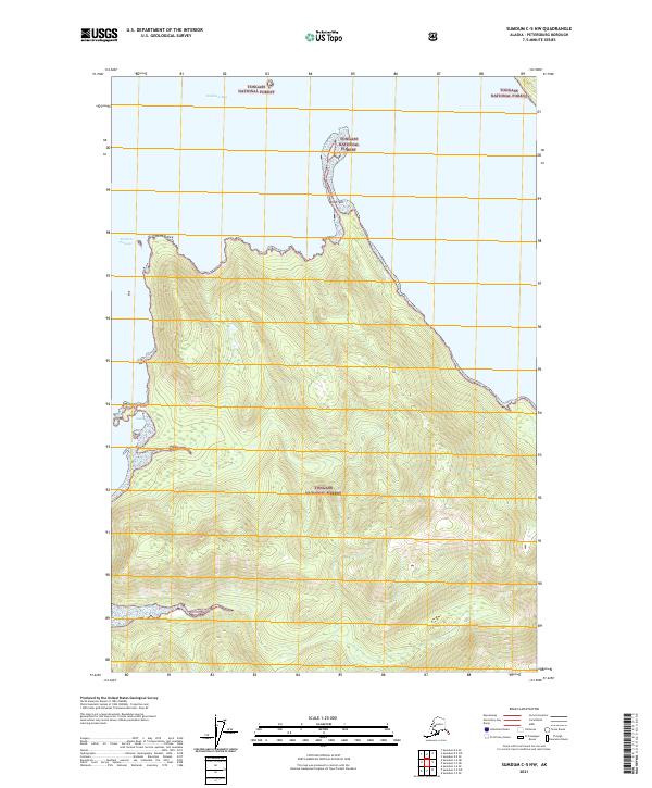
2021 Map of Sumdum C-5 NW
USGS Topo · Published 2021About this map
Stephens Passage and Holkham Bay dominate the northern coast of this coastal wilderness within the Tongass National Forest. The landscape is defined by its dramatic maritime features, including the hooked protrusion of Wood Spit and the southern reach of Sand Spit, which provide critical reference points for navigation in these Southeast Alaskan waters. The interior remains an undeveloped expanse of steep topography, where the Tongass National Forest boundary protects the pristine maritime forest ecosystem. Grounded in the late twentieth and early twenty-first-century mapping of the Petersburg Borough, the chart details the interface between the high-relief coastal mountains and the surrounding fjords, specifically at the prominent geographic marker of Point Astley.
Find a feature on this map
12 named features on this map. Tap any name to fly to it.
Don’t see what you’re looking for? This feature index may not catch every label — zoom into the map to look around manually.
Map Details
Editions of this 2021 Sumdum C-5 NW Map
This is the sole edition of this map. No revisions or reprints were ever made.
Other maps of this area

1948 · Sumdum D-6
USGS Topo · 1:63,360

1948 · Sumdum C-5
USGS Topo · 1:63,360

1948 · Sumdum C-6
USGS Topo · 1:63,360

1948 · Sumdum D-5
USGS Topo · 1:63,360

1951 · Sumdum C-5
USGS Topo · 1:63,360

1951 · Sumdum D-6
USGS Topo · 1:63,360

1951 · Sumdum C-6
USGS Topo · 1:63,360

1952 · Sumdum
USGS Topo · 1:250,000

1955 · Sumdum D-5
USGS Topo · 1:63,360

1961 · Sumdum
USGS Topo · 1:250,000