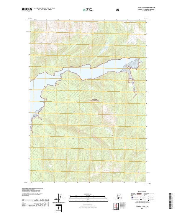
2021 Map of Sumdum C-5 SE
USGS Topo · Published 2021About this map
Windham Bay dominates this coastal landscape within the Tongass National Forest, showing the intricate shoreline and steep topography characteristic of the Petersburg Borough region. The waterway transitions through The Narrows, where the bay constricts before opening into a larger body of water to the east. Several drainage systems define the inland terrain, most notably Taylor Cr, which feeds into the isolated Taylor Lake in the northern portion of the map. Smaller watercourses like Sylvia Cr and Slate Cr descend from the ridges, providing a clear picture of the natural watersheds in this undeveloped maritime environment. The survey captures the interface of dense forest and tidal waters, illustrating the complex geography of the Alaskan Panhandle.
Find a feature on this map
11 named features on this map. Tap any name to fly to it.
Don’t see what you’re looking for? This feature index may not catch every label — zoom into the map to look around manually.
Map Details
Editions of this 2021 Sumdum C-5 SE Map
This is the sole edition of this map. No revisions or reprints were ever made.
Other maps of this area

1943 · Sumdum B-4
USGS Topo · 1:63,360

1948 · Sumdum C-5
USGS Topo · 1:63,360

1948 · Sumdum B-5
USGS Topo · 1:63,360

1948 · Sumdum B-4
USGS Topo · 1:63,360

1951 · Sumdum C-5
USGS Topo · 1:63,360

1951 · Sumdum B-5
USGS Topo · 1:63,360

1952 · Sumdum
USGS Topo · 1:250,000

1961 · Sumdum C-4
USGS Topo · 1:63,360

1961 · Sumdum
USGS Topo · 1:250,000

1996 · Sumdum B-4
USGS Topo · 1:63,360