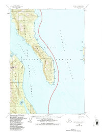
1951 Map of Sumdum C-6
USGS Topo · Published 1985About this map
Admiralty Island dominates this mid-century coastal survey, specifically where the land mass narrows into the prominent Glass Peninsula. The map illustrates a landscape defined by federal stewardship, bifurcated between the Tongass National Forest and the Admiralty Island National Monument (Wilderness). Navigational landmarks such as Midway Pt and Pt League line the edges of Stephens Passage and the Seymour Canal, serving as critical reference points in an area with no established roads or trails. High peaks like Yeek-Sha Mtn provide vertical contrast to the extensive Tidal Flat areas of Pleasant Bay. This data, based on 1948 aerial photography and 1889 hydrographic surveys, preserves the precise boundaries of the Lighthouse Reserve and other maritime markers long used for Alaska coastal navigation.
Find a feature on this map
19 named features on this map. Tap any name to fly to it.
Don’t see what you’re looking for? This feature index may not catch every label — zoom into the map to look around manually.
Map Details
Editions of this 1951 Sumdum C-6 Map
3 editions found

Other maps of this area

1948 · Sitka D-1
USGS Topo · 1:63,360

1948 · Sitka B-1
USGS Topo · 1:63,360

1948 · Sitka C-1
USGS Topo · 1:63,360

1948 · Sumdum D-6
USGS Topo · 1:63,360

1948 · Sumdum C-5
USGS Topo · 1:63,360

1948 · Sumdum B-6
USGS Topo · 1:63,360

1948 · Sumdum C-6
USGS Topo · 1:63,360

1948 · Sumdum B-5
USGS Topo · 1:63,360

1948 · Sumdum D-5
USGS Topo · 1:63,360

1951 · Sitka
USGS Topo · 1:250,000