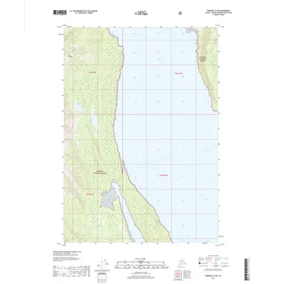
2017 Map of Sumdum C-6 SW
USGS Topo · Published 2017About this map
Tongass National Forest dominates the coastal landscape of Admiralty Island in this maritime survey, where the saltwater Seymour Canal divides the dense forested terrain. The map emphasizes the isolation of the coastline, defined by intricate tidal inlets and steep slopes that rise directly from the water's edge. At the northwestern edge of the sheet, the peak of Yeek-Sha Mtn serves as a prominent navigational landmark overlooking the northern reaches of the canal. The absence of roads or established settlements reflects the coastal wilderness character of the region, where the Public Land Survey System grid lines for t49s r71e and t50s r71e delineate administrative boundaries across undeveloped shorelines and timberlands.
Find a feature on this map
7 named features on this map. Tap any name to fly to it.
Don’t see what you’re looking for? This feature index may not catch every label — zoom into the map to look around manually.
Map Details
Editions of this 2017 Sumdum C-6 SW Map
This is the sole edition of this map. No revisions or reprints were ever made.
Other maps of this area

1948 · Sitka B-1
USGS Topo · 1:63,360

1948 · Sitka C-1
USGS Topo · 1:63,360

1948 · Sumdum B-6
USGS Topo · 1:63,360

1948 · Sumdum C-6
USGS Topo · 1:63,360

1951 · Sitka
USGS Topo · 1:250,000

1951 · Sitka C-1
USGS Topo · 1:63,360

1951 · Sitka B-1
USGS Topo · 1:63,360

1951 · Sumdum C-6
USGS Topo · 1:63,360

1952 · Sumdum
USGS Topo · 1:250,000

1952 · Sitka
USGS Topo · 1:250,000