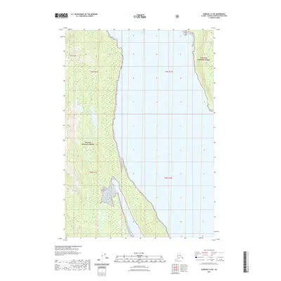
2021 Map of Sumdum C-6 SW
USGS Topo · Published 2021About this map
Seymour Canal dominates the central portion of this coastal topographic survey, dividing the steep terrain into distinct eastern and western ridges. This landscape is entirely contained within the Tongass National Forest, illustrating the remote and protected character of the Alexander Archipelago. On the western landmass, Yeek-Sha Mtn rises sharply from the shoreline, its steep contours reflecting the dramatic vertical relief of the Alaska Panhandle. The map reveals a wild, unpopulated environment defined by glacial geology and dense forest, where the only human-imposed structures are the cadastral boundary lines of townships t49s r71e and t50s r71e. The detailed hydrography shows numerous small drainage patterns feeding into the canal, marking a wilderness state largely untouched by modern development.
Find a feature on this map
7 named features on this map. Tap any name to fly to it.
Don’t see what you’re looking for? This feature index may not catch every label — zoom into the map to look around manually.
Map Details
Editions of this 2021 Sumdum C-6 SW Map
This is the sole edition of this map. No revisions or reprints were ever made.
Other maps of this area

1948 · Sitka B-1
USGS Topo · 1:63,360

1948 · Sitka C-1
USGS Topo · 1:63,360

1948 · Sumdum B-6
USGS Topo · 1:63,360

1948 · Sumdum C-6
USGS Topo · 1:63,360

1951 · Sitka
USGS Topo · 1:250,000

1951 · Sitka C-1
USGS Topo · 1:63,360

1951 · Sitka B-1
USGS Topo · 1:63,360

1951 · Sumdum C-6
USGS Topo · 1:63,360

1952 · Sumdum
USGS Topo · 1:250,000

1952 · Sitka
USGS Topo · 1:250,000