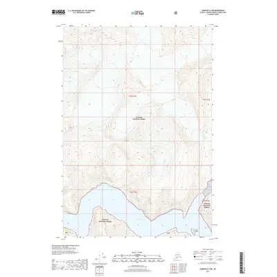
2017 Map of Sumdum D-4 NW
USGS Topo · Published 2017About this map
Tracy Arm cuts deeply into the glacier-carved landscape of Southeast Alaska within this 2017 survey. The fjord is dominated by the massive Sawyer Glacier at its eastern terminus, where ice meets the marine waters of the Tongass National Forest. The map shows a terrain of steep, high-elevation contours and glacial features, including the small, isolated Sawyer Island positioned near the glacier's face. The lack of roads or infrastructure highlights the protected wilderness character of the Tongass National Forest boundaries in this remote coastal corridor. Topographic lines reveal the dramatic verticality of the surrounding peaks that frame the narrow waterway, documenting the ongoing interaction between ice and sea in the Hoonah-Angoon Census Area.
Find a feature on this map
9 named features on this map. Tap any name to fly to it.
Don’t see what you’re looking for? This feature index may not catch every label — zoom into the map to look around manually.
Map Details
Editions of this 2017 Sumdum D-4 NW Map
This is the sole edition of this map. No revisions or reprints were ever made.
Other maps of this area

1948 · Sumdum D-5
USGS Topo · 1:63,360

1951 · Taku River A-4
USGS Topo · 1:63,360

1951 · Taku River A-5
USGS Topo · 1:63,360

1952 · Sumdum
USGS Topo · 1:250,000

1953 · Taku River
USGS Topo · 1:250,000

1955 · Sumdum D-5
USGS Topo · 1:63,360

1960 · Taku River
USGS Topo · 1:250,000

1960 · Sumdum D-4
USGS Topo · 1:63,360

1961 · Sumdum
USGS Topo · 1:250,000
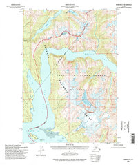
1994 · Sumdum D-5
USGS Topo · 1:63,360