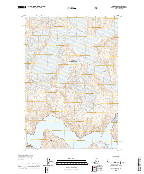
2021 Map of Sumdum D-4 NW
USGS Topo · Published 2021About this map
Tongass National Forest dominates the landscape of this coastal Alaskan region, where steep glacial topography meets the saltwater of Tracy Arm. The map documents a dramatic glacial environment, specifically the terminus area of the Sawyer Glacier and the adjacent Sawyer Island. This 2021 survey provides a high-resolution view of the interaction between ice and sea, showing the complex contouring of the fjord's walls as they descend into the narrow waterway. The absence of human-built infrastructure highlights the remote and protected nature of this wilderness area within the Hoonah-Angoon Census Area, preserving a detailed record of the shoreline and ice positions as they existed during the early twenty-first century.
Find a feature on this map
8 named features on this map. Tap any name to fly to it.
Don’t see what you’re looking for? This feature index may not catch every label — zoom into the map to look around manually.
Map Details
Editions of this 2021 Sumdum D-4 NW Map
This is the sole edition of this map. No revisions or reprints were ever made.
Other maps of this area

1948 · Sumdum D-5
USGS Topo · 1:63,360

1951 · Taku River A-4
USGS Topo · 1:63,360

1951 · Taku River A-5
USGS Topo · 1:63,360

1952 · Sumdum
USGS Topo · 1:250,000

1953 · Taku River
USGS Topo · 1:250,000

1955 · Sumdum D-5
USGS Topo · 1:63,360

1960 · Taku River
USGS Topo · 1:250,000

1960 · Sumdum D-4
USGS Topo · 1:63,360

1961 · Sumdum
USGS Topo · 1:250,000
1994 · Sumdum D-5
USGS Topo · 1:63,360