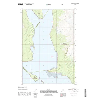
2017 Map of Sumdum D-5 SW
USGS Topo · Published 2017About this map
Tongass National Forest dominates the coastline where several major administrative boundaries meet in this remote Alaskan maritime landscape. The map captures the intersection of the Juneau Borough Hoonah-Angoon Census Area and the Hoonah-Angoon Census Area Petersburg Borough. This coastal wilderness is defined by deep inlets and protected waterways, including the expansive Endicott Arm and the sheltered Williams Cove. Offshore, Harbor Island and the smaller Round Islets stand as distinct landmarks within the tidal zone. The presence of Powers Cr flowing into the saltwater provides a focal point for understanding the local drainage patterns and terrain as they existed in the early twenty-first century.
Find a feature on this map
11 named features on this map. Tap any name to fly to it.
Don’t see what you’re looking for? This feature index may not catch every label — zoom into the map to look around manually.
Map Details
Editions of this 2017 Sumdum D-5 SW Map
This is the sole edition of this map. No revisions or reprints were ever made.
Other maps of this area

1948 · Sumdum D-6
USGS Topo · 1:63,360

1948 · Sumdum C-5
USGS Topo · 1:63,360

1948 · Sumdum C-6
USGS Topo · 1:63,360

1948 · Sumdum D-5
USGS Topo · 1:63,360

1951 · Sumdum C-5
USGS Topo · 1:63,360

1951 · Sumdum D-6
USGS Topo · 1:63,360

1951 · Sumdum C-6
USGS Topo · 1:63,360

1952 · Sumdum
USGS Topo · 1:250,000

1955 · Sumdum D-5
USGS Topo · 1:63,360

1961 · Sumdum
USGS Topo · 1:250,000