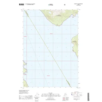
2017 Map of Sumdum D-6 NW
USGS Topo · Published 2017About this map
Stephens Passage dominates this maritime landscape of Southeast Alaska, where the waters of Port Snettisham meet the mainland. The shoreline is defined by prominent coastal markers including Point Styleman to the north and Point Anmer further south, providing essential navigation points for the region's historical fishing and transport lanes. Much of the terrestrial terrain is protected as part of the Tongass National Forest, showing a coastline that remains largely undeveloped and primarily influenced by natural tidal and glacial forces.
Find a feature on this map
14 named features on this map. Tap any name to fly to it.
Don’t see what you’re looking for? This feature index may not catch every label — zoom into the map to look around manually.
Map Details
Editions of this 2017 Sumdum D-6 NW Map
This is the sole edition of this map. No revisions or reprints were ever made.
Other maps of this area

1948 · Sitka D-1
USGS Topo · 1:63,360

1948 · Sumdum D-6
USGS Topo · 1:63,360

1951 · Juneau
USGS Topo · 1:250,000

1951 · Taku River A-6
USGS Topo · 1:63,360

1951 · Sitka
USGS Topo · 1:250,000

1951 · Juneau A-1
USGS Topo · 1:63,360

1951 · Sitka D-1
USGS Topo · 1:63,360

1951 · Sumdum D-6
USGS Topo · 1:63,360

1952 · Sumdum
USGS Topo · 1:250,000

1952 · Sitka
USGS Topo · 1:250,000