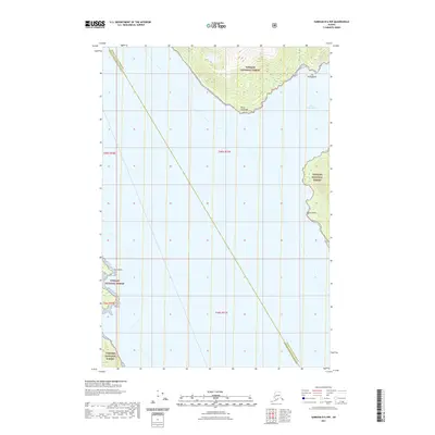
2021 Map of Sumdum D-6 NW
USGS Topo · Published 2021About this map
Port Snettisham dominates the maritime geography of this coastal region, where deep water meets the steep, timbered slopes of the Tongass National Forest. The landscape is defined by its dramatic shoreline features, including Point Styleman and Point Anmer, which serve as critical navigation points along the inlet. The inland terrain is characterized by sharp elevation changes, particularly around the drainage of Mist Cr, which flows toward the protected waters near Mist Island. A significant administrative boundary bisects the waters here, marking the divide between the Juneau City and Borough and the Hoonah-Angoon Census Area. This layout reflects the area's role as a rugged maritime corridor, where human activity is largely dictated by the deep-water access of the sound and the steep, restricted topography of the national forest.
Find a feature on this map
12 named features on this map. Tap any name to fly to it.
Don’t see what you’re looking for? This feature index may not catch every label — zoom into the map to look around manually.
Map Details
Editions of this 2021 Sumdum D-6 NW Map
This is the sole edition of this map. No revisions or reprints were ever made.
Other maps of this area

1948 · Sitka D-1
USGS Topo · 1:63,360

1948 · Sumdum D-6
USGS Topo · 1:63,360

1951 · Juneau
USGS Topo · 1:250,000

1951 · Taku River A-6
USGS Topo · 1:63,360

1951 · Sitka
USGS Topo · 1:250,000

1951 · Juneau A-1
USGS Topo · 1:63,360

1951 · Sitka D-1
USGS Topo · 1:63,360

1951 · Sumdum D-6
USGS Topo · 1:63,360

1952 · Sumdum
USGS Topo · 1:250,000

1952 · Sitka
USGS Topo · 1:250,000