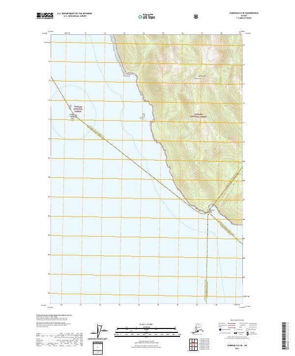
2021 Map of Sumdum D-6 SE
USGS Topo · Published 2021About this map
The wilderness of Southeast Alaska's Alexander Archipelago is documented here through its steep coastal topography and federal land boundaries. Tongass National Forest dominates the terrestrial landscape, rising sharply from the shoreline to the heights of Meigs Peak. The rugged coastline is punctuated by Point Coke, a prominent headland where the land meets the cold waters of the Holkham Bay region. Further offshore, the Midway Islands sit as isolated outcroppings in the open water. This 2021 survey illustrates the complex administrative geography of the region, showing the jurisdictional intersection of the Juneau City and Borough, the Hoonah-Angoon Census Area, and the Petersburg Borough. The map captures the raw, undeveloped character of the Alaskan Panhandle, where transport is dictated entirely by maritime routes and the sheer verticality of the coastal mountains.
Find a feature on this map
10 named features on this map. Tap any name to fly to it.
Don’t see what you’re looking for? This feature index may not catch every label — zoom into the map to look around manually.
Map Details
Editions of this 2021 Sumdum D-6 SE Map
This is the sole edition of this map. No revisions or reprints were ever made.
Other maps of this area

1948 · Sumdum D-6
USGS Topo · 1:63,360

1948 · Sumdum C-5
USGS Topo · 1:63,360

1948 · Sumdum C-6
USGS Topo · 1:63,360

1948 · Sumdum D-5
USGS Topo · 1:63,360

1951 · Sumdum C-5
USGS Topo · 1:63,360

1951 · Sumdum D-6
USGS Topo · 1:63,360

1951 · Sumdum C-6
USGS Topo · 1:63,360

1952 · Sumdum
USGS Topo · 1:250,000

1955 · Sumdum D-5
USGS Topo · 1:63,360

1961 · Sumdum
USGS Topo · 1:250,000