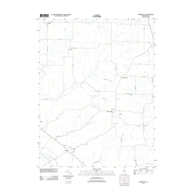
2012 Map of Summer Hill
USGS Topo · Published 2012About this map
Summer Hill and the small settlements of Atlas and New Hartford anchor this portion of Pike County, where the landscape is defined by the winding paths of Ambrosia Cr and Atlas Cr. For genealogists and local historians, the area is remarkably dense with family-named burial sites, including Taylor Martin Cem, Shinn Cem, and Wombles Cem. In the southwestern corner, the topography shifts near The Sny and Spatterdock Lake, reflecting the low-lying hydrology near the Mississippi river bottomlands. Cultural markers of the modern era are also present, such as the Clark 54 Drive-In, which stands along the route between Summer Hill and Atlas. The network of township roads, including Dutch-Town Rd and Ambrosier Rd, connects these rural communities across a terrain of creeks like Crozier Cr and Dutch Cr.
Find a feature on this map
54 named features on this map. Tap any name to fly to it.
Don’t see what you’re looking for? This feature index may not catch every label — zoom into the map to look around manually.
Map Details
Editions of this 2012 Summer Hill Map
This is the sole edition of this map. No revisions or reprints were ever made.
Other maps of this area

1890 · Louisiana
USGS Topo · 1:125,000

1926 · Pittsfield
USGS Topo · 1:62,500

1930 · Nebo
USGS Topo · 1:62,500

1931 · Barry
USGS Topo · 1:62,500

1934 · Nebo
USGS Topo · 1:48,000

1936 · Barry
USGS Topo · 1:48,000

1937 · Bowling Green
USGS Topo · 1:62,500

1940 · Bowling Green
USGS Topo · 1:62,500

1942 · Nebo
USGS Topo · 1:62,500

1944 · Barry
USGS Topo · 1:62,500