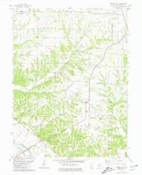
1981 Map of Summer Hill
USGS Topo · Published 1981About this map
El Dara and New Hartford anchor the northern reaches of this Pike County landscape, where the rolling hills of Derry and Martinsburg townships meet the bottomlands of The Sny Cutoff. The map reveals a high density of rural burial sites, including Worobles Cem, Prairie Mound Cem, and Shinn Cem, which provide significant data points for genealogists tracking early settler families. The local economy is defined by agriculture and drainage systems like The Levee, while the presence of a Drive-in Theater near Summer Hill reflects mid-century social patterns in rural Illinois.
Find a feature on this map
34 named features on this map. Tap any name to fly to it.
Don’t see what you’re looking for? This feature index may not catch every label — zoom into the map to look around manually.
Map Details
Editions of this 1981 Summer Hill Map
This is the sole edition of this map. No revisions or reprints were ever made.
Other maps of this area

1890 · Louisiana
USGS Topo · 1:125,000

1926 · Pittsfield
USGS Topo · 1:62,500

1930 · Nebo
USGS Topo · 1:62,500

1931 · Barry
USGS Topo · 1:62,500

1934 · Nebo
USGS Topo · 1:48,000

1936 · Barry
USGS Topo · 1:48,000

1937 · Bowling Green
USGS Topo · 1:62,500

1940 · Bowling Green
USGS Topo · 1:62,500

1942 · Nebo
USGS Topo · 1:62,500

1944 · Barry
USGS Topo · 1:62,500