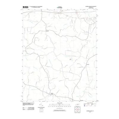
2010 Map of Summer Shade
USGS Topo · Published 2010About this map
Summer Shade serves as a primary hub in this portion of Metcalfe County, where the landscape is defined by a dense network of country roads and creek drainages. The topography is shaped by significant watercourses like Falling Timber Creek and Clay Lick Creek, which carve through the terrain near features such as Miner Hollow and Cave Ridge. The area's rural character is emphasized by small settlements like Randolph, Goodluck, and Beaumont, which remain connected by long-established routes.
Find a feature on this map
73 named features on this map. Tap any name to fly to it.
Don’t see what you’re looking for? This feature index may not catch every label — zoom into the map to look around manually.
Map Details
Editions of this 2010 Summer Shade Map
This is the sole edition of this map. No revisions or reprints were ever made.
Other maps of this area

1935 · Horse Cave
USGS Topo · 1:48,000

1938 · Horse Cave
USGS Topo · 1:62,500

1953 · Sulphur Well
USGS Topo · 1:24,000

1953 · Sulphur Lick
USGS Topo · 1:24,000

1953 · Temple Hill
USGS Topo · 1:24,000

1953 · Freedom
USGS Topo · 1:24,000

1953 · Edmonton
USGS Topo · 1:24,000

1953 · Summer Shade
USGS Topo · 1:24,000

1953 · Dubre
USGS Topo · 1:24,000

1953 · East Fork
USGS Topo · 1:24,000