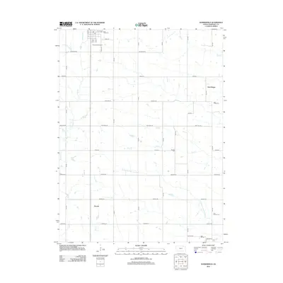
2012 Map of Summerfield
USGS Topo · Published 2012About this map
Summerfield anchors this Marshall County landscape near the Nebraska border, situated at the headwaters of Robidoux Cr and Snipe Cr. The settlement's residential grid, including Front St and Valley St, is supplemented by the nearby Summerfield Airport and a local Po. This 2012 survey illustrates a transition from the structured town sites of Saint Bridget and Summit to the expansive agricultural sections defined by a named road network of Alamo Rd, Bison Rd, and Cherokee Rd. Genealogists will find a concentration of burial sites across the territory, from the Holy Family Cem in the north to Saint Michael's Cem and Rose Hill Cem in the southeast. The drainage patterns of the N Fork Black Vermillion River and Clear Cr dictate the terrain, where rural life remains tied to these persistent waterways and the section-line roads that frame them.
Find a feature on this map
40 named features on this map. Tap any name to fly to it.
Don’t see what you’re looking for? This feature index may not catch every label — zoom into the map to look around manually.
Map Details
Editions of this 2012 Summerfield Map
This is the sole edition of this map. No revisions or reprints were ever made.
Other maps of this area

1889 · Seneca
USGS Topo · 1:125,000

1894 · Seneca
USGS Topo · 1:125,000

1955 · Manhattan
USGS Topo · 1:250,000

1955 · Lincoln
USGS Topo · 1:250,000

1956 · Manhattan
USGS Topo · 1:250,000

1957 · Manhattan
USGS Topo · 1:250,000

1957 · Lincoln
USGS Topo · 1:250,000

1958 · Lincoln
USGS Topo · 1:250,000

1965 · Pawnee City
USGS Topo · 1:24,000
1965 · Liberty SE
USGS Topo · 1:24,000