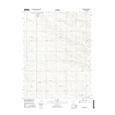
2015 Map of Summerfield
USGS Topo · Published 2015About this map
Summerfield and the surrounding Marshall County landscape appear here in a modern survey, characterized by a strictly organized grid of agricultural roads and scattered historic landmarks. The town's northern edge is defined by a dense cluster of streets, including Main St and Valley St, while the broader rural landscape is dotted with generational burial sites such as Holy Family Cem and Saint Bridget Cem. This drainage pattern is dominated by the N Fork Black Vermillion River, which meanders across the southern sections, along with tributaries like Robidoux Cr and Clear Cr. Further south, the map details the settlement of Axtell and the smaller locality of Summit, illustrating the persistent rural network of small Kansas communities connected by roads like Arrowhead Rd and Frontier Rd.
Find a feature on this map
44 named features on this map. Tap any name to fly to it.
Don’t see what you’re looking for? This feature index may not catch every label — zoom into the map to look around manually.
Map Details
Editions of this 2015 Summerfield Map
This is the sole edition of this map. No revisions or reprints were ever made.
Other maps of this area

1889 · Seneca
USGS Topo · 1:125,000

1894 · Seneca
USGS Topo · 1:125,000

1955 · Manhattan
USGS Topo · 1:250,000

1955 · Lincoln
USGS Topo · 1:250,000

1956 · Manhattan
USGS Topo · 1:250,000

1957 · Manhattan
USGS Topo · 1:250,000

1957 · Lincoln
USGS Topo · 1:250,000

1958 · Lincoln
USGS Topo · 1:250,000

1965 · Pawnee City
USGS Topo · 1:24,000
1965 · Liberty SE
USGS Topo · 1:24,000