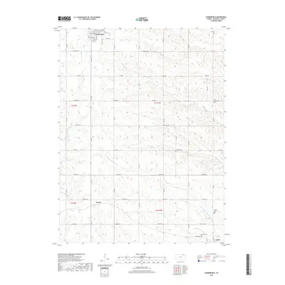
2018 Map of Summerfield
USGS Topo · Published 2018About this map
Summerfield sits at the northern edge of this Marshall County landscape, where a grid of rural roads like Alamo Rd and Arrowhead Rd connects scattered farmsteads across the rolling divide. This 2018 survey reveals a territory defined by its cemeteries and watercourses, illustrating the deep-rooted settlement patterns of the Kansas-Nebraska borderlands. Genealogy researchers will find several well-marked burial sites, including Holy Family Cem and Summerfield Cem near the town center, as well as the more remote Saint Bridget Cem to the east.
Find a feature on this map
38 named features on this map. Tap any name to fly to it.
Don’t see what you’re looking for? This feature index may not catch every label — zoom into the map to look around manually.
Map Details
Editions of this 2018 Summerfield Map
This is the sole edition of this map. No revisions or reprints were ever made.
Other maps of this area

1889 · Seneca
USGS Topo · 1:125,000

1894 · Seneca
USGS Topo · 1:125,000

1955 · Manhattan
USGS Topo · 1:250,000

1955 · Lincoln
USGS Topo · 1:250,000

1956 · Manhattan
USGS Topo · 1:250,000

1957 · Manhattan
USGS Topo · 1:250,000

1957 · Lincoln
USGS Topo · 1:250,000

1958 · Lincoln
USGS Topo · 1:250,000

1965 · Pawnee City
USGS Topo · 1:24,000
1965 · Liberty SE
USGS Topo · 1:24,000