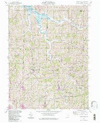
1994 Map of Summerfield
USGS Topo · Published 1998About this map
Summerfield serves as the primary hub in this corner of Noble County, where the landscape is defined by the steep ridges and narrow valleys of southeastern Ohio. The northern reaches are dominated by Senecaville Lake, a product of the Muskingum Watershed Conservancy District management. The map details a rural geography punctuated by several family-named cemeteries such as Glady Cem, Aaron Cem, and Bethesda Cem, reflecting generations of settlement in townships like Seneca and Marion.
Find a feature on this map
51 named features on this map. Tap any name to fly to it.
Don’t see what you’re looking for? This feature index may not catch every label — zoom into the map to look around manually.
Map Details
Editions of this 1994 Summerfield Map
This is the sole edition of this map. No revisions or reprints were ever made.
Other maps of this area

1903 · Macksburg
USGS Topo · 1:62,500

1905 · New Matamoras
USGS Topo · 1:62,500

1905 · Woodsfield
USGS Topo · 1:62,500

1905 · Macksburg
USGS Topo · 1:62,500

1909 · Summerfield
USGS Topo · 1:62,500

1911 · Summerfield
USGS Topo · 1:62,500

1924 · New Matamoras
USGS Topo · 1:62,500

1926 · New Matamoras
USGS Topo · 1:62,500

1949 · Clarksburg
USGS Topo · 1:250,000

1956 · Clarksburg
USGS Topo · 1:250,000