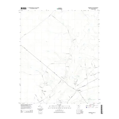
2014 Map of Summerville NW
USGS Topo · Published 2014About this map
Lebanon and the surrounding Berkeley County countryside appear here as a patchwork of wetlands and rural road networks near the upper reaches of the Ashley River. The landscape is defined by its water systems, including the serpentine paths of Black Cr, Big Run, and Caton Cr, which feed into the primary river channel. This 2014 survey documents the persistence of small rural communities and family-named landmarks in the South Carolina Lowcountry. Local genealogists will find several burial sites recorded, such as Wassamassaw Cem and Lebanon Cem, alongside the smaller Rudd Cem and Blanton Cem. The map illustrates how modern developments like Miracle Dr and Ambassador Ave have begun to interface with older thoroughfares like Mudville Rd and Longridge Rd, showcasing the evolving settlement patterns near the community of Long Ridge.
Find a feature on this map
51 named features on this map. Tap any name to fly to it.
Don’t see what you’re looking for? This feature index may not catch every label — zoom into the map to look around manually.
Map Details
Editions of this 2014 Summerville NW Map
This is the sole edition of this map. No revisions or reprints were ever made.
Other maps of this area

1919 · Summerville
USGS Topo · 1:48,000

1919 · Ridgeville
USGS Topo · 1:48,000

1920 · Eutawville
USGS Topo · 1:48,000

1920 · Chicora
USGS Topo · 1:48,000

1920 · Ridgeville
USGS Topo · 1:62,500

1920 · Summerville
USGS Topo · 1:62,500

1921 · Chicora
USGS Topo · 1:62,500

1921 · Eutawville
USGS Topo · 1:62,500

1943 · Chicora
USGS Topo · 1:62,500

1943 · Ridgeville
USGS Topo · 1:62,500